- BR MGUFV MUS CAR.01.01.02.01.019
- Item
- 1922
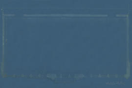
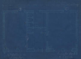
Part of Acervo Cartográfico da Universidade Federal de Viçosa
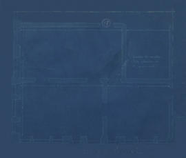
Rascunho da planta baixa do Salão Nobre do Prédio Principal.
Part of Acervo Cartográfico da Universidade Federal de Viçosa
Rascunho da planta baixa do Salão Nobre do Prédio Principal.
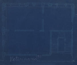
Part of Acervo Cartográfico da Universidade Federal de Viçosa
Rascunho da planta baixa da sala 38 (Veterinária) e escada do Prédio Principal.

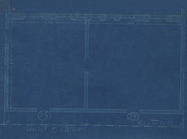
Part of Acervo Cartográfico da Universidade Federal de Viçosa
Rascunho da planta baixa da sala 37 (Pecuária) e escada do Prédio Principal.
Part of Acervo Cartográfico da Universidade Federal de Viçosa
Rascunho da planta baixa das salas 36 (Anatomia e Parasitologia) e 34 (História do Brasil e Geografia) do Prédio Principal.
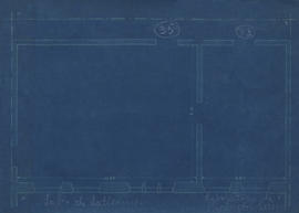
Part of Acervo Cartográfico da Universidade Federal de Viçosa
Rascunho. Planta baixa das salas 35 (Laboratório de laticínios) e 33 (Laboratório de produtos suínos) do Prédio Principal.
Part of Acervo Cartográfico da Universidade Federal de Viçosa
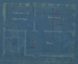
Rascunho da planta baixa da sala 30 (Laboratório de Fitopatologia - classe, laboratório) e escada do Prédio Principal.
Part of Acervo Cartográfico da Universidade Federal de Viçosa
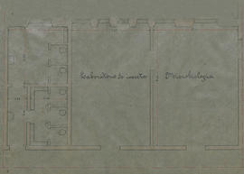
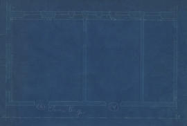
Planta baixa das salas 26 (Laboratório de insetos), 28 (Microbiologia) e de um banheiro do Prédio Principal.
Part of Acervo Cartográfico da Universidade Federal de Viçosa
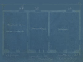
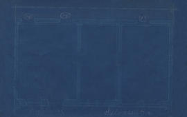
Rascunho da planta baixa das salas 23 (Meteorologia), 25 (Exposição de minerais, adubos, etc.) e 27 (Mostruário de solos e adubos) do Prédio Principal.
Part of Acervo Cartográfico da Universidade Federal de Viçosa
Rascunho da planta baixa das salas 22 (Matemática), 32 (Português) e de uma escada do Prédio Principal.
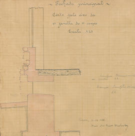
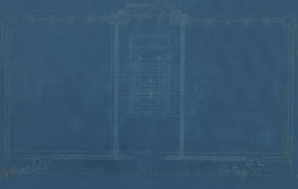
Corte pelo eixo da primeira janela
Part of Acervo Cartográfico da Universidade Federal de Viçosa
Corte pelo eixo da primeira janela do primeiro corpo da fachada principal.
Mario das Neves Machado
Part of Acervo Cartográfico da Universidade Federal de Viçosa
Rascunho da planta baixa da sala 18 do Prédio Principal.
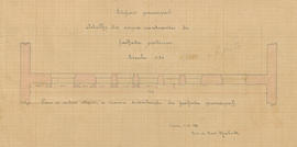
Part of Acervo Cartográfico da Universidade Federal de Viçosa
Detalhe dos corpos reentrantes da fachada posterior do Prédio Principal.
Mario das Neves Machado
Trecho da planta da ESAV (parte 4)
Part of Acervo Cartográfico da Universidade Federal de Viçosa
Planta topográfica com curvas de nível, indicações de construções, vias, controle de erosão, estrada de ferro Leopoldina e córrego na ESAV - parte 04.
Part of Acervo Cartográfico da Universidade Federal de Viçosa
Rascunho. Planta baixa da sala 17 (Engenharia Rural) do Prédio Principal.
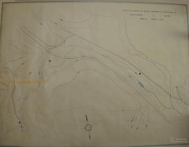
Trecho da planta da ESAV (parte 3)
Part of Acervo Cartográfico da Universidade Federal de Viçosa
Planta topográfica com curvas de nível, indicações de construções, vias e córrego do Barbado na ESAV - parte 03.

Part of Acervo Cartográfico da Universidade Federal de Viçosa
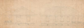
Planta da fachada posterior do Prédio Principal.
Mario das Neves Machado
Part of Acervo Cartográfico da Universidade Federal de Viçosa
Rascunho da planta baixa das salas 16 (Química Orgânica) e 14 do Prédio Principal.
Part of Acervo Cartográfico da Universidade Federal de Viçosa
Rascunho da planta baixa das salas 15 (Engenharia Rural) e 13 (Silvicultura) do Prédio Principal.
Trecho da planta da ESAV (parte 2)
Part of Acervo Cartográfico da Universidade Federal de Viçosa
Planta topográfica com curvas de nível, indicações de construções, vias, barragem e córrego do Barbado na ESAV - parte 02.
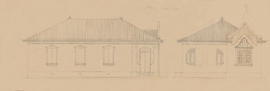
Part of Acervo Cartográfico da Universidade Federal de Viçosa
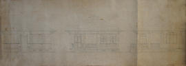
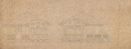
Fachada da residência de professores.
Part of Acervo Cartográfico da Universidade Federal de Viçosa
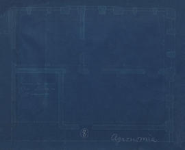
Rascunho da planta baixa da sala 08 (Agronomia) do Prédio Principal.
Part of Acervo Cartográfico da Universidade Federal de Viçosa
Fachada da residência de professores.
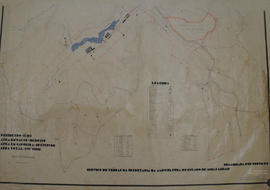
Trecho da planta da ESAV (parte 1)
Part of Acervo Cartográfico da Universidade Federal de Viçosa
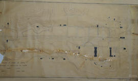
Planta topográfica com curvas de nível, indicações de construções, vias e córrego do Barbado na Esav - parte 01.
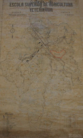
Part of Acervo Cartográfico da Universidade Federal de Viçosa
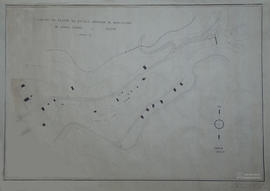
Planta topográfica com curvas de nível da ESAV.
Conteúdo equivalente aos itens 002 e 003, em menor escala.
Part of Acervo Cartográfico da Universidade Federal de Viçosa
Fachada da residência de professores.
Part of Acervo Cartográfico da Universidade Federal de Viçosa
Rascunho da planta baixa da sala 07 (Horticultura e Pomicultura) do Prédio Principal.
Part of Acervo Cartográfico da Universidade Federal de Viçosa
Rascunho da planta baixa das salas 03 (Biblioteca do diretor), 05 (Produtos Horticultura e Pomicultura) e de um dos banheiros do Prédio Principal.
Rascunho do projeto estrutural
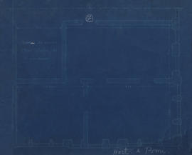
Part of Acervo Cartográfico da Universidade Federal de Viçosa
Projeto estrutural da fundação. Segundo informações do colecionador, local: Dormitório.
Mário das Neves Machado
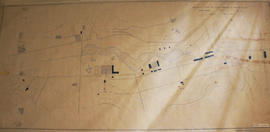
Planta da ESAV (parte inferior)
Part of Acervo Cartográfico da Universidade Federal de Viçosa
Planta topográfica com representação do relevo (curvas de nível) da ESAV de uso e ocupação. Parte inferior.
Perímetro: 15,289ha. Área de pasto: 181,818750ha. Área de capoeira: 107,587500ha. Área total: 575,719112ha.
Secretaria de Agricultura de Minas Gerais (SAMG)
Part of Acervo Cartográfico da Universidade Federal de Viçosa
Fachada da residência de professores (número 5).