- BR MGUFV MUS CAR.01.01.02.001
- Item
- s/d
Part of Acervo Cartográfico da Universidade Federal de Viçosa
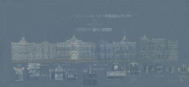
Planta da fachada originalmente projetada do Prédio Principal da Esav, incluindo detalhamentos de partes.
Benedito Quintino dos Santos
Part of Acervo Cartográfico da Universidade Federal de Viçosa
Planta da fachada originalmente projetada do Prédio Principal da Esav, incluindo detalhamentos de partes.
Benedito Quintino dos Santos
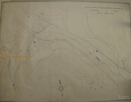
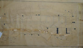
Trecho da planta da ESAV (parte 4)
Part of Acervo Cartográfico da Universidade Federal de Viçosa
Planta topográfica com curvas de nível, indicações de construções, vias, controle de erosão, estrada de ferro Leopoldina e córrego na ESAV - parte 04.
Trecho da planta da ESAV (parte 3)
Part of Acervo Cartográfico da Universidade Federal de Viçosa
Planta topográfica com curvas de nível, indicações de construções, vias e córrego do Barbado na ESAV - parte 03.
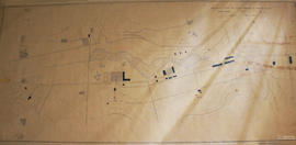
Trecho da planta da ESAV (parte 2)
Part of Acervo Cartográfico da Universidade Federal de Viçosa
Planta topográfica com curvas de nível, indicações de construções, vias, barragem e córrego do Barbado na ESAV - parte 02.
Trecho da planta da ESAV (parte 1)
Part of Acervo Cartográfico da Universidade Federal de Viçosa
Planta topográfica com curvas de nível, indicações de construções, vias e córrego do Barbado na Esav - parte 01.
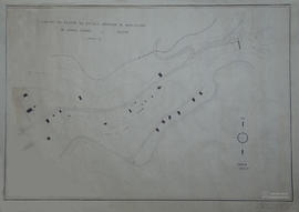
Part of Acervo Cartográfico da Universidade Federal de Viçosa
Planta topográfica com curvas de nível da ESAV.
Conteúdo equivalente aos itens 002 e 003, em menor escala.
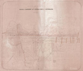
Planta da ESAV (parte inferior)
Part of Acervo Cartográfico da Universidade Federal de Viçosa
Planta topográfica com representação do relevo (curvas de nível) da ESAV de uso e ocupação. Parte inferior.
Perímetro: 15,289ha. Área de pasto: 181,818750ha. Área de capoeira: 107,587500ha. Área total: 575,719112ha.
Secretaria de Agricultura de Minas Gerais (SAMG)
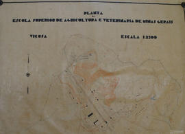
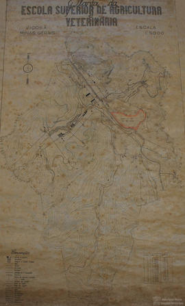
Planta da ESAV (parte superior)
Part of Acervo Cartográfico da Universidade Federal de Viçosa
Planta topográfica com representação do relevo (curvas de nível) da ESAV de uso e ocupação. Contendo esboço da atual Vila Gianetti.
Mauro Chaves (Copiador)
Part of Acervo Cartográfico da Universidade Federal de Viçosa
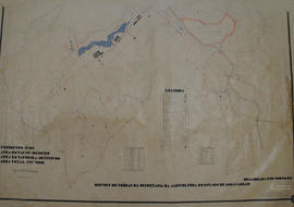
Planta topográfica com curvas de nível e divisa dos terrenos pertencentes a ESAV, com os nomes das fazendas ou donos e seus respectivos confrontantes.